This Week in Weather — July 19, 2026
Severe weather rearview, storm reports, and the forecast pattern for the week of July 19, 2026.
Rearview
Nine confirmed tornadoes and 908 wind reports against 55 hail reports: last week's severe weather ran almost entirely in the wind-dominant mode, with the Northeast absorbing the sharpest end of it.
 NWS Aberdeen, SD / NOAA
The most concentrated sequence came Saturday evening, July 18, when five tornado warnings dropped across the mid-Atlantic and southern tier in roughly 20 minutes. At 6:24 p.m. EDT, the Wakefield office issued for Dorchester and Wicomico counties in Maryland. Three minutes later, Philadelphia followed with a warning covering Sussex County, Delaware and Caroline County, Maryland. Binghamton was working a separate track simultaneously — Delaware and Sullivan counties in New York at 6:47 p.m. EDT. The overnight continuation into early Sunday moved the action into Pennsylvania: Centre, Blair, and Clearfield counties at 8:16 p.m. EDT, then Huntingdon County at 8:43 p.m. EDT. New York led all states for the week with 112 storm reports; Pennsylvania followed at 102.
 NOAA NESDIS
The week's seismic signature was harder to ignore. A M7.3 struck 58 km WSW of Puerto Madero, Mexico on July 17 at 8:48 a.m. local time — the largest earthquake globally in the past several weeks. A M6.2 followed near Sarangani in the southern Philippines, and a M5.5 hit outside Sicaya, Peru. None of the three generated confirmed destructive tsunami activity, but the Puerto Madero event was deep enough in the Cocos subduction zone to produce strong shaking across a wide radius of coastal Chiapas and Guatemala.
Space weather was quiet. The week's Kp maximum was 0, and the strongest X-ray event was a C9.0 — energetic by C-class standards but well below the threshold for any operational impact.
GOES-East visible composite, July 18, 2026 — the convective line responsible for the evening mid-Atlantic tornado warnings. Storm-relative motion vectors indicate a forward-propagating mode.
Roadmap
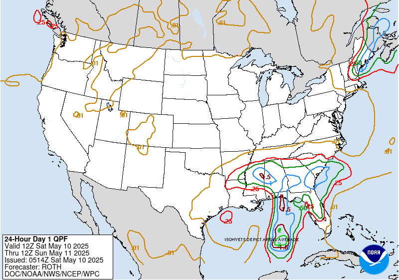
The dominant feature shaping the next seven days is a broad, resilient upper-level ridge anchored over the South-Central U.S. Its western flank is suppressing convection from Dallas to Denver in the lower half of the week, while its eastern margin is creating the moisture and instability gradient that will keep the Northeast active. A secondary shortwave trough digging from the Great Lakes toward the Ohio Valley on July 21 is the week's most significant forcing mechanism — it's the system most likely to produce organized convection across the largest geographic footprint.
Northeast. The New York area carries a 77% precipitation probability on July 21, tied directly to that shortwave passage. An average weekly high of 85°F keeps the atmosphere primed — dewpoints in the upper 60s are plausible ahead of the trough, which is enough to sustain convective initiation well into the evening. Total weekly precipitation of 2.92 inches is substantial; if that verifies, it will fall across a region already sensitized to flash flooding after last week's rounds. The Flood Advisory count (601 FA.Y) in the warning data is not a coincidence — the Northeast's soil and urban drainage infrastructure is running near capacity.
South Plains and Mountain West. Dallas averages 107°F for the week with essentially zero precipitation signal — a 8% peak probability on July 19 that reflects a marginal moisture return, not a genuine convective threat. The ridge is doing exactly what ridges do in late July over Texas: it is a heat press, and there is no trough close enough to lift it. Denver tells a different story. A 99°F average high paired with an 86% precipitation probability on July 23 reflects the monsoon moisture that has been slowly deepening across the Four Corners. That combination — extreme surface heat, elevated terrain, and a deepening subtropical moisture plume — sets up the classic Colorado afternoon convective cycle, which can produce locally intense rainfall and hail despite modest weekly totals of 0.16 inches.
500 hPa analysis valid July 21, 2026. The shortwave trough approaching the Great Lakes is the primary forcing mechanism for Northeast convection mid-week.
Southeast and Midwest. Atlanta's 93°F average high with only 0.38 inches of weekly precipitation is the suppression signature of sitting on the western flank of the Bermuda High — instability is present, but the capping subsidence is winning most days. Chicago at 81°F with a 61% precipitation probability on July 21 is the northern edge of that same shortwave influence; expect a convective window Tuesday but a relatively quiet remainder.
International. London's 79°F average high for the week is roughly 10°F above the July climatological mean for the city. The mechanism is a persistent ridge over Western Europe that has been deflecting the Atlantic storm track northward into Scandinavia. No precipitation of note is forecast.
The week's structure is straightforward in outline but consequential in detail: a dominant ridge baking the south while a single mid-week shortwave does the heavy lifting for the Northeast, a region that does not need more rainfall but is almost certainly going to receive it. Watch the July 21 window — it is where the week's meaningful weather is concentrated.
 NOAA/NWS Weather Prediction Center