Super El Nino Looms as Severe Weather Erupts Across the US
A potential record-breaking Super El Nino is building in the Pacific while a multi-day severe weather outbreak targets the Southern Plains through the Great Lakes this week. California gets soaked too.
The Biggest Climate Story of 2026 Is Taking Shape
While most of us are focused on the day-to-day forecast, something massive is developing in the tropical Pacific that could reshape weather patterns worldwide for the next year and a half. Multiple forecast models are now pointing toward a Super El Nino -- and some scientists are calling it potentially the strongest in over a century.
NOAA's Climate Prediction Center currently has us in ENSO-neutral territory, but El Nino is expected to emerge by late spring with a 61% probability through May-July. The latest ECMWF guidance is more aggressive, showing a 75% chance of a Super El Nino by October. ENSO expert Paul Roundy has said there is "real potential for the strongest El Nino event in 140 years."
If that bears out, we are talking about Pacific sea surface temperatures running more than 2 degrees Celsius above average -- the kind of anomaly that rewrites seasonal forecasts from the US to Australia.

What a Super El Nino Means for the US
For those of us watching weather across the country, here is the playbook if a strong El Nino locks in:
- Southern US: Wetter and cooler than normal through fall and winter, with an active subtropical jet stream feeding storm after storm into the Gulf Coast, Texas, and the Southeast
- Northern US: Warmer and drier, with a weakened polar jet and reduced snowfall potential for the Great Lakes and northern Plains
- California: Enhanced rainfall through fall and winter, with an increased chance of atmospheric river events -- exactly the kind of pattern that produced the January flooding earlier this year
- Atlantic hurricane season: Suppressed activity as increased upper-level wind shear tears apart developing tropical systems. Colorado State University's early forecast already reflects this, calling for a below-average season
If the European model is correct and this El Nino continues into winter, either 2026 or 2027 is almost certain to set a new record for the warmest year on the instrument record.
This Week: Severe Outbreak Monday Through Wednesday
But we do not need to wait for El Nino to see action. This week is loaded.
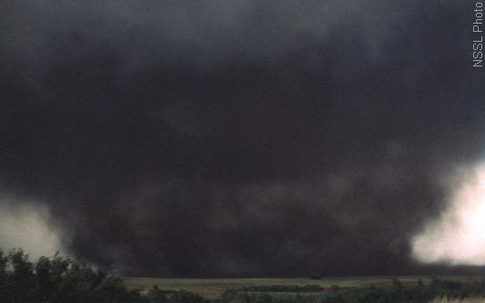
A multi-day severe weather outbreak is setting up from the Southern Plains to the Great Lakes starting Monday, April 13. The Storm Prediction Center's Day 4-8 outlook highlights a significant threat running Monday through Wednesday, with tornado outbreak potential peaking Monday and Tuesday.
The engine behind this setup is a massive warm sector with mid-60s dewpoints flooding the region -- an extraordinary level of atmospheric moisture for mid-April. That is explosive fuel for severe thunderstorm development.
Monday, April 13 brings the most widespread risk. The threat zone stretches from Dallas and Kansas City in the south through St. Louis, Chicago, and Minneapolis in the north. All modes of severe weather are on the table: tornadoes, large hail, and damaging wind gusts.
Tuesday, April 14 shifts the focus to the central Mississippi Valley and Midwest corridor, with the risk zone draped across St. Louis, Kansas City, Detroit, and Chicago. The same large-scale pattern continues to drive development.
Wednesday, April 15 sees lingering risk across the Southern Plains through the Midwest, though coverage should start to contract.
If you are anywhere from Texas to the Great Lakes this week, now is the time to review your severe weather plan.
California Gets Another Soaking
Meanwhile, on the West Coast, rain is moving through Southern California this weekend. Los Angeles and Orange counties are looking at a quarter to a half inch of rain through Sunday, with highs only reaching the mid-60s.
The bigger story is farther north. The California coast north of LA could see a general 2 to 4 inches through Monday evening, with 4 to 8 inches along the lower west-facing slopes of the northern Sierra Nevada. That is a significant rainfall event for mid-April and keeps the state well ahead of normal precipitation totals for the water year.
Summer-Like Heat East of the Rockies
In between the storms, much of the central and eastern US is running well above average on temperatures this week. Summer-like heat will be commonplace east of the Rockies, with highs pushing into the 80s and lower 90s by midweek. That warmth is part of what is fueling the severe weather risk -- warm, moist air at the surface colliding with upper-level energy creates the instability that thunderstorms thrive on.
Bottom Line
- A potential record-breaking Super El Nino is building in the Pacific, with a 75% chance of reaching supercharged status by October according to ECMWF models
- Multi-day severe weather outbreak targets the Southern Plains through Great Lakes Monday through Wednesday, with tornado outbreak potential peaking Monday and Tuesday
- California sees 2 to 8 inches of rain through Monday, heaviest in the northern Sierra
- Summer-like heat in the 80s and 90s spreads across the central and eastern US midweek