This Week in Weather — August 23, 2026
Severe weather rearview, storm reports, and the forecast pattern for the week of August 23, 2026.
Rearview
The week's signature number is 2,033 — wind reports logged by the Storm Prediction Center across seven days, a figure that dwarfs the 244 hail reports and 25 confirmed tornadoes and tells you something about the convective character of the period: fast, linear, and relentlessly wind-driven.
The most concentrated tornado sequence unfolded on the evening of August 22 into early August 23 (EDT/local). A warning for Cuyahoga and Lorain counties in Ohio dropped at 5:01 PM EDT on August 22. Three hours later, separate warnings fired for Centre and Clearfield counties in Pennsylvania — the first at 7:58 PM EDT, a second at 8:11 PM EDT, two distinct cells or circulations requiring back-to-back coverage from the State College (CTP) office within 13 minutes. Just after 9:26 PM EDT, Scott County in Virginia received its own tornado warning from the Morristown (MRX) office. Four warnings across three states in roughly four hours, all anchored along the mid-Atlantic slope — consistent with a fast-tracking convective system riding a sharp moisture gradient.
 NOAA NESDIS
The Great Plains saw its own activity earlier that same night. Logan County, Colorado received a tornado warning at 9:32 PM MDT on August 21, followed by warnings for Cheyenne and Kimball counties in Nebraska at 8:19 PM MDT on August 22 — separate convective rounds separated by 24 hours, both in the classic terrain corridor where upslope flow and dryline interaction favor supercell development.
Alabama led all states with 236 storm reports for the week, followed by Mississippi (182), North Carolina (165), and Kentucky (152) — a southeastern-weighted distribution that reflects the week's moisture axis.
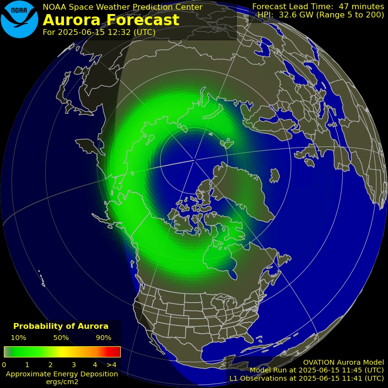
On the space weather side, an M8.1 solar flare peaked at 11:42 UTC on August 20, the strongest X-ray event of the week, though the geomagnetic response was negligible: maximum Kp reached 0. Seismically, a M6.7 struck 31 km northwest of Aniso, Peru at 18:00 UTC on August 20.
 USGS / Wikimedia Commons
Composite radar mosaic, August 22, 2026. The linear convective mode responsible for the multi-state tornado warning sequence is visible as a northeast-tracking band along the Appalachian slope.
Roadmap
The pattern for the coming seven days is organized around a ridge anchored over the southern tier, with its axis running from the Desert Southwest through Texas and into the Gulf Coast states. That ridge is not moving appreciably. Dallas averages 106°F for the week with a weekly precipitation total of 0.03 inches and a maximum precipitation probability of 10 percent on August 23 — a signal that the cap is not breaking. The South Plains will remain under heat advisory conditions through the forecast period, and the absence of any credible forcing mechanism means the heat there is not a short-duration event to manage around; it is the baseline.
The Northeast is the week's most active quadrant. New York City averages 84°F with 2.56 inches of precipitation through the seven-day period — an order of magnitude wetter than any other region in the dataset. The peak probability, 59 percent, falls on August 27. That timing and that precipitation volume suggest a front or shortwave delivering multiple rounds of convection rather than a single organized system. The region's flash flood exposure is already elevated after the past week's 239 flash flood warnings nationally, and another multi-inch rainfall event in urban and suburban terrain will put storm drain infrastructure under pressure again. Watch the August 27 window closely; if a slow-moving front stalls over the mid-Atlantic, the rainfall totals could concentrate in a way the weekly average doesn't capture.
500 mb height anomaly forecast, August 24–28. The ridge axis over Texas and the Southwest is clearly defined; the Pacific trough is the mechanism that will eventually erode the pattern's western edge.
Atlanta averages 93°F with just 0.13 inches of precipitation for the week — hot, stable, and largely convectively suppressed. The Southeast is under the western periphery of a Bermuda High that is keeping moisture largely bottled and preventing significant frontal penetration. The 55 percent precipitation probability on August 27 may reflect the same frontal boundary affecting the Northeast as it clips the Carolinas, but the totals suggest a glancing interaction rather than a direct hit.
Denver averages 92°F with a 47 percent precipitation probability on August 25 — the Mountain West's window for afternoon convection. That probability is consistent with a shortwave dropping through the region mid-week, enhancing instability enough to trigger storms in the terrain before the ridge reasserts itself. The weekly total of 0.20 inches is modest but not trivial for a region where afternoon thunderstorms are the primary summer precipitation delivery mechanism.
Chicago averages 78°F with 0.15 inches for the week. The Midwest sits in a relative quiet zone between the active Northeast and the suppressed South — comfortable by late-August standards, with minimal organized convective threat.
San Francisco's forecast is the simplest: 71°F average high, 0.00 inches of precipitation, 4 percent peak probability on August 28. The marine layer is in control, the ridge is offshore, and Northern California's fire weather window remains a function of offshore flow events rather than precipitation.
London averages 73°F for the week — near-normal for late August, and consistent with a pattern in which the Atlantic storm track has been displaced northward.
Looking Ahead
- The August 27 precipitation window in the Northeast carries the week's highest flash flood potential; urban areas from New Jersey through southern New England should monitor short-range model output by mid-week for rainfall rate and total accumulation guidance.
- Dallas and the broader South Plains will remain under dangerous heat through the full forecast period, with no credible break in the ridge; heat risk is not a mid-week event but a sustained exposure problem requiring ongoing management.
- The M8.1 flare on August 20 produced no meaningful geomagnetic response, but solar activity is worth monitoring if additional M- or X-class events occur — a coronal mass ejection with better Earth-directed geometry could push Kp above the quiet levels seen this week.
 NOAA SWPC