Super Typhoon Bavi Crossed the Marianas at 180 mph
Super Typhoon Bavi crossed the Northern Marianas at 180 mph. Why the western Pacific runs hot, and how ocean heat content drives rapid intensification.
On August 19, 2026, Super Typhoon Bavi crossed the Northern Mariana Islands with sustained winds estimated at 180 mph — the third Category 5-equivalent storm to form in the western Pacific this calendar year, and the third to do so before the Atlantic season had produced anything close to a comparable threat. That asymmetry is not coincidence.
Why the Western Pacific Runs Hot
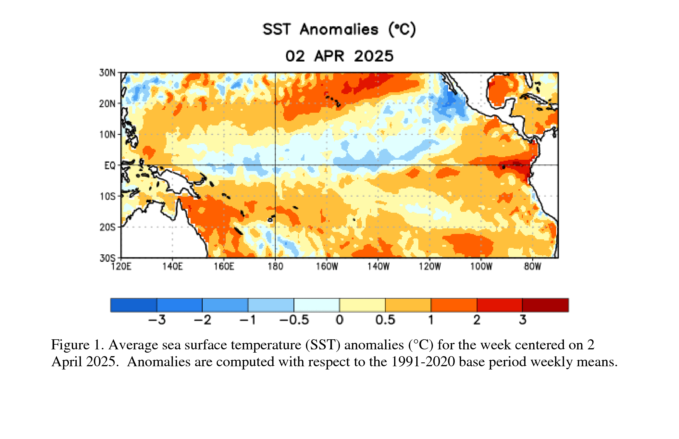
The Philippine Sea and the waters east of Guam sit above some of the deepest warm water on the planet. Sea surface temperatures in that corridor have been running well above average this summer, but the more consequential number is the depth of the 26°C isotherm — the layer of water warm enough to sustain a tropical cyclone even after the storm's own mixing churns cooler water upward from below. When that warm layer extends to 100 meters or deeper, a storm can intensify without effectively undercutting its own fuel supply.
NOAA CPC
Bavi exploited exactly that setup. The Joint Typhoon Warning Center tracked it through a period of rapid intensification — defined as a sustained wind increase of at least 35 mph in 24 hours — that pushed it from a tropical storm to a Category 5 equivalent in roughly 36 hours. That pace is not unprecedented, but it is increasingly common. The 2026 season has now logged three such events before September, a rate that matches the most active years on record for rapid intensification in the western Pacific.
The mechanism is straightforward in outline, if difficult to predict in practice. Rapid intensification requires low vertical wind shear — the change in wind speed and direction between the lower and upper troposphere — because strong shear tilts the storm's vertical column and disrupts the organized convection that drives the heat engine. It also requires high mid-level humidity, which suppresses the dry-air entrainment that can erode the inner core. Bavi had both: shear values below 10 knots and relative humidity above 70% at 500 millibars through most of its intensification window.
What made the timing particularly dangerous for Guam and the CNMI is that rapid intensification events compress the warning timeline. A storm that intensifies two categories in 30 hours gives emergency managers far less runway than a storm that signals its peak intensity 72 hours out.
The MJO's Fingerprints
Sitting behind all three of this year's western Pacific Category 5 storms is a signal that rarely appears in public forecasts but drives much of the season's rhythm: the Madden-Julian Oscillation. The MJO is a pulse of enhanced convection and rainfall that propagates eastward around the tropics on a 30-to-60-day cycle. When its active phase sits over the western Pacific — phases 6 and 7 on the standard 8-phase wheel — it suppresses wind shear, moistens the mid-levels, and increases low-level cyclonic vorticity, creating conditions that favor both genesis and intensification.
The MJO has been locked in an anomalously persistent active phase over the western Pacific since late July. That persistence is unusual; the oscillation typically propagates through a full cycle in four to eight weeks. When it stalls, the favorable window for storm development extends well beyond what seasonal forecasters predicted. Bavi formed inside that window. So did the two storms that preceded it.
The Atlantic has been comparatively quiet — a contrast that underscores how basin-asymmetric this season has been. If the MJO's active envelope eventually shifts eastward, which current model guidance suggests may happen in September, that would remove one of the primary suppressants currently keeping the Atlantic subdued.
Storm Surge Over Flat Reef Platforms
One detail specific to Guam and the CNMI that gets less attention than wind speed: the island platforms are fringed by shallow reef shelves that can amplify storm surge in ways that open-ocean bathymetry does not. When a typhoon's onshore flow pushes water across a broad, nearly flat reef shelf, the surge can stack faster and higher than the same wind speed would produce against a steeply sloping seafloor. Bavi's track brought its northeast eyewall — statistically the most intense quadrant for a westward-moving system in the northern hemisphere — directly over Tinian and the southern tip of Saipan. Post-storm surveys will likely show surge values that exceed what the wind speed alone would imply.
That physics applies anywhere a major cyclone crosses a shallow coastal shelf at close to a right angle, including parts of the Gulf Coast, the Bay of Bengal, and the South China Sea. The storm's wind speed is the headline number, but the seafloor geometry is often what determines whether a surge is survivable.
Field Notes
- Track the MJO's phase position weekly through September; a shift toward phases 1-3 would signal reduced western Pacific activity and a potential uptick in Atlantic and eastern Pacific genesis.
- Rapid intensification forecasts from the NHC and JTWC now include probabilistic guidance — the percentage chance of a 35-mph or 55-mph increase in 24 hours — which is more operationally useful than a single intensity number when planning around storm timing.
- For any coastal location with a reef shelf or broad continental shelf, NOAA's storm surge inundation maps are keyed to storm category at landfall, but local topography can push actual surge well above the category's central estimate; the local National Weather Service office publishes watch-specific surge zones that account for this.