This Week in Weather
Rearview of the past 7 days and the pattern shaping the week ahead.
Rearview
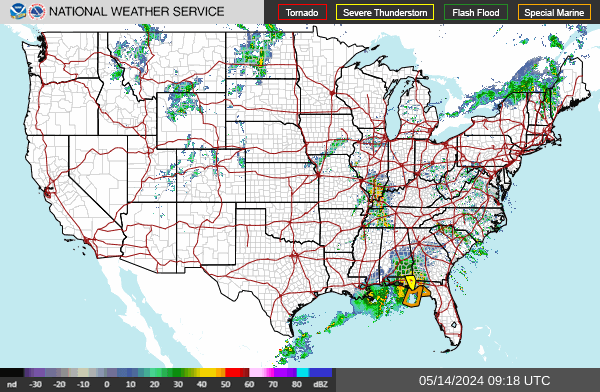
The week produced 169 tornado warnings — enough to establish this as a legitimately active severe weather period, not a routine summer stretch. The most concentrated sequence came out of North Dakota early on June 28, when the Bismarck office issued four tornado warnings between 9:44 p.m. and 11:29 p.m. CDT, rotating through Burleigh, Emmons, Kidder, Morton, and Oliver counties across two overlapping warning polygons. That kind of rapid-fire issuance from a single office, all converging on the same cluster of counties, points to a discrete supercell or tight storm cluster rather than a broad squall line.
 NOAA/NWS
Separate from the Northern Plains activity, tornado warnings also fired across the Tennessee-Kentucky border late that same evening. Cumberland, Fentress, and Putnam counties in Tennessee drew a warning at 7:57 p.m. CDT from the Nashville office, followed eight minutes later by a warning for Christian County, Kentucky from Paducah. Two distinct geographic threads, same night.
The SPC storm report totals for the week tell the rest of the story: 1,281 wind reports, 428 hail reports, 125 tornado reports. Colorado led all states with 198 combined reports, followed by Oklahoma at 165 and North Carolina at 152 — an unusual southeastern presence in a week dominated by Plains convection.
On June 24, a magnitude 7.5 earthquake struck 28 km southeast of Yumare, Venezuela at 10:05 p.m. local time. That is the largest seismic event in the dataset and one of the stronger South American earthquakes in recent years. The week also included a 6.9 near Kuji, Japan and a 6.5 southwest of Sarangani in the Philippines, continuing a pattern of elevated activity along the Pacific Rim.
Space weather was quiet by any measure — peak Kp of 0 for the week, with the strongest solar X-ray event reaching only C9.5 class.
Roadmap
The dominant feature shaping the next seven days across the contiguous U.S. is a broad, anchored upper-level ridge centered over the southern tier and extending northeastward. This is not a transient warm spell — the ridge appears locked in place through at least July 5, which means the heat accumulates rather than cycles out. The practical result is a week of above-normal temperatures from Dallas to New York with minimal precipitation relief for most of the country.
South Plains and Southeast. Dallas is forecast to average 100°F for the week with essentially no rainfall — 0.01 inches total, peak precipitation probability of 2% on June 29. Atlanta is not far behind at 98°F average with 0.12 inches of precipitation projected for the full seven days. These numbers reflect a ridge strong enough to suppress convective initiation even in regions where Gulf moisture is present at low levels. When the cap holds this firmly through multiple consecutive days, heat stress compounds — overnight lows stay elevated, and the atmosphere never fully unloads its moisture content. The July 4 weekend arrives with a 32% precipitation probability in Atlanta, but that signal is diffuse enough that it likely represents isolated afternoon convection rather than any organized system.
Northeast. New York City averages 96°F through the week, with the lone meaningful precipitation window also clustering around July 4 at 32% probability. The mechanism there may be a shortwave trough attempting to undercut the ridge from the north — worth watching for severe weather potential if the timing aligns with peak afternoon instability. A surface trough or sea breeze boundary could act as a focusing mechanism for any convection that does initiate.
Midwest. Chicago averages 92°F with zero projected precipitation through the full seven days. That is a notable forecast — a week of zero measurable rainfall across the upper Midwest during late June and early July is not typical, and it reflects the ridge's northward extent suppressing any Pacific or Canadian systems that might otherwise deliver relief. Soil moisture deficits will widen quickly under this pattern.
 NOAA NESDIS / STAR
Mountain West and Pacific. Denver sits at 94°F average with minimal precipitation (0.02 inches), though the slight elevation in probability on June 30 at 15% suggests a weak disturbance moving through the Four Corners region — possibly enough to trigger isolated afternoon thunderstorms over the higher terrain. San Francisco holds at 72°F with zero precipitation and a 3% peak probability, which is simply a normal early-July marine layer pattern. The coast is insulated from the interior heat event.
International callout. London is forecast to average 78°F through the week — warm for the Thames Valley but not record territory. The relevant context is that northwestern Europe has been running anomalously warm through much of June, and a 78°F average high in London for early July represents continuation of that pattern rather than a break from it.
Looking Ahead
- Monitor the July 4 shortwave signal for the Northeast — if the trough arrives with enough amplitude, the combination of 96°F surface temperatures and afternoon instability could produce a brief but sharp severe weather window across the mid-Atlantic and southern New England.
- The South Plains heat event through Dallas is forecast to persist without interruption; anyone with outdoor obligations in that region should plan around a week where afternoon heat index values will routinely exceed 105°F.
- The Venezuela M7.5 on June 24 warrants continued attention for aftershock activity — significant earthquakes at that magnitude commonly generate sequences that extend two to four weeks, and the northern South American subduction zone remains seismically active.
 USGS
USGS